


UPDATE at 9:30p.m. on 12/9/2025: Milwaukee and Waukesha counties have now been added to the ongoing Winter Weather Advisory. The National Weather Service’s Winter Weather Advisory has been extended in Ozaukee, Sheboygan, Milwaukee and Waukesha Counties until 9a.m. on Wednesday. Snowfall totals are 1 to 2 inches higher than the previous forecast along and north of I-94 up to around Beaver Dam and West Bend.
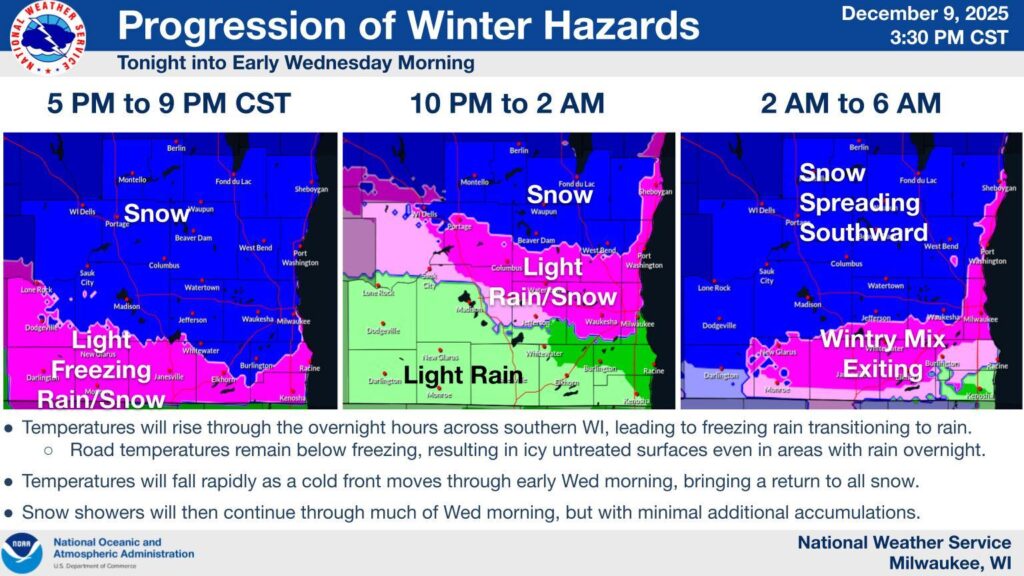
UPDATE at 8:34p.m. on 12/9/2025: The National Weather Service’s Winter Weather Advisory is currently ongoing. As of 8:00p.m. in far southern WI, the wintry mix is transitioning to all rain. Untreated surfaces will be slippery. Elsewhere, mainly snow is falling. Periods of moderate snow can accumulate on roads and cause slippery stretches.

Image courtesy of the National Weather Service Milwaukee/Sullivan
UPDATE at 4:15 p.m. on 12/9/2025: The National Weather Service‘s Winter Weather Advisory will start at 6:00 p.m. on December 9 through 6:00 a.m. on December 10 with a mix of snow, rain, and freezing rain along and south of I-90/I-94 and all snow across central WI. The counties being impacted include Ozaukee, Sheboygan, Fond du Lac, Dodge, Washington, and Jefferson counties.
Snow is expected to spread across all regions this evening, transitioning to wintry mix across southern Wisconsin as temperatures warm tonight.
Colder temperatures will return by the morning, with all snow expected.
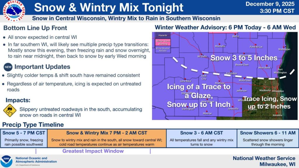

UPDATE at 9:00 a.m. on 12/9/2025: The National Weather Service expands the Winter Weather Advisory to account for some freezing rain potential in addition to the snow in southwest WI. The counties being impacted include Ozaukee, Sheboygan, Fond du Lac, Dodge, Washington, and Jefferson counties until 6:00 a.m. on on December 10.
There remains several uncertainties with this system in regards to the transition zone and the implications of subtle shifts in the track of this event.


SULLIVAN, Wis. — The National Weather Service has issued a Winter Weather Advisory for Dodge, Fond du Lac, Sheboygan and Ozaukee counties.
The advisory begins Tuesday, December 9 at 6:00 p.m. and ends Wednesday, December 10 at 6:00 a.m.
The NWS expects wet snow that will create slippery road conditions. The snow will likely transition to freezing rain Tuesday night before transitioning back to lighter snow Wednesday morning.
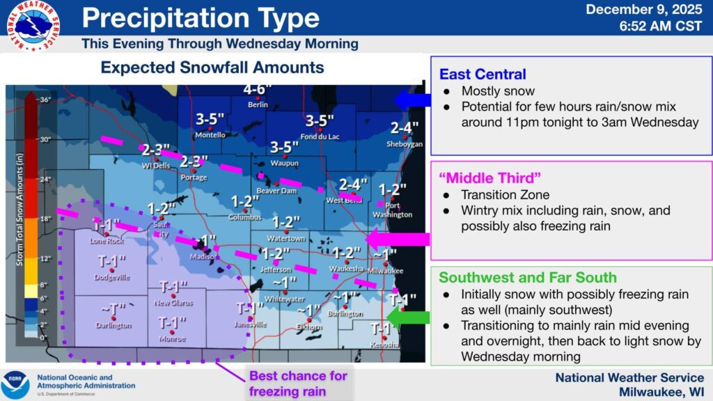
Snow totals are expected between two and five inches.
Wintry Mix precipitation event is expected Tuesday afternoon into Wednesday. However, lots of uncertainty persists with this system but impacts to the Tuesday evening/Wednesday morning commutes are likely for at least parts of southern WI. #wiwx pic.twitter.com/KRxW0LHkWK
— NWS Milwaukee (@NWSMilwaukee) December 8, 2025
WTMJ severe weather coverage is sponsored by Fleet Farm.
