


UPDATE at 2:05 p.m. on 4/16/2026: The National Weather Service confirms one additional tornado from April 14. An EF-0 tornado developed near the intersection of Plank Rd. and County Highway J near Rochester in Racine County.
It traveled 3.9 miles ending near Plank Rd., just east of South Cox Rd, with a maximum wind speed of 85 mph. It caused minor structural damage to barnes and outbuildings, and uprooted and snapped trees.
No injuries were reported from any of the tornados on April 14.
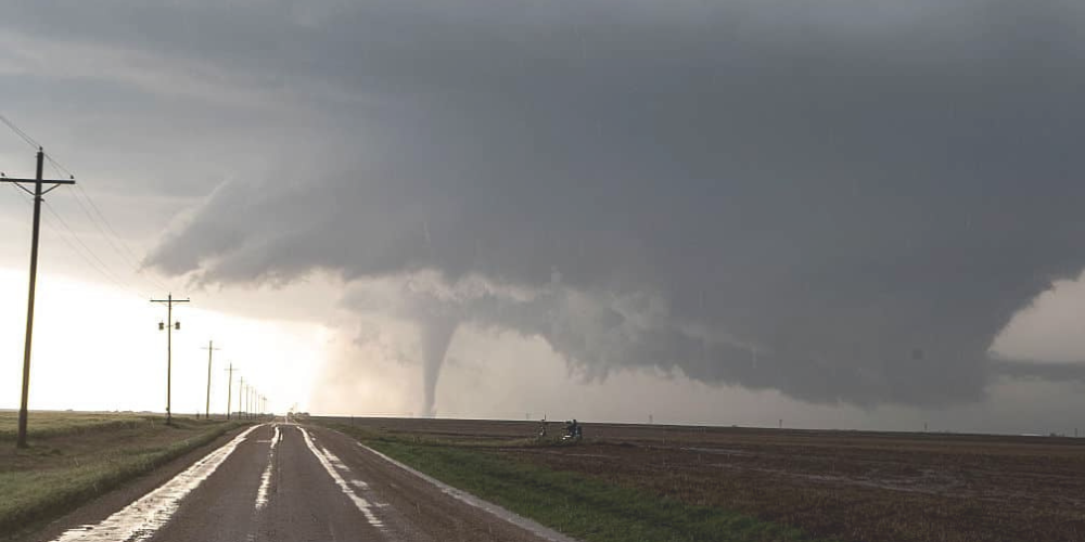
SULLIVAN, Wis. — Preliminary data from the National Weather Service‘s damage surveys shows five tornados touched down in southern Wisconsin during two rounds of severe weather on April 14.
The first occurred in the overnight hours, with damaging winds from 60 to 70 mph that reached across southern Wisconsin.
An EF-0 tornado started south of Beaver Dam at 12:44 a.m., and “went through a garage near Shaw Hill Rd, west of the Shaw Marsh Wildlife Area.” It was on the ground for about a minute, traveled .27 miles, was 50 yards wide, and had peak winds at 85 mph.
The second occurred during the evening hours with “numerous supercell thunderstorms which transitioned to a squall line with embedded tornadoes.” Hail measuring to the size of softballs were recorded near Madison. There were four tornados documented so far in southeast Wisconsin as surveys continue.
The first was an EF-2 tornado that touched down near the Town of Lisbon at 6:24 p.m., and was on the ground for four minutes as it traveled 3.12 miles with winds topping out at 120 mph.
“Tornado appeared to develop in the Lisbon Oaks subdivision, causing mainly tree damage before intensifying closer to Highway 164.” It was the most intense near Indian Grass Lane, damaging multiple businesses, including an insurance car shop port that had its roof completely blown off and found approximately 3-4 blocks to the east near Highway 164, and the Lisbon Presbyterian Church near Wildwood Way. “The tornado appeared to end around or just to the east of the Butler Nature Preserve.”
The second was an EF-1 tornado near Endeavor that touched down at 6:26 p.m. “Tornado started near Grouse Rd east of Briggsville and then tracked to the northeast”. The worst damage was to an onion farm
south of County Road O before the tornado crossed I-39 and dissipated near County Rd CX. The tornado was on the ground for 6 minutes as it traveled 4.87 miles with peak winds at 109 mph.
Another EF-1 tornado touched down at 8:26pm near East Troy, traveling 7.36 miles in 8 minutes. “Tornado started northwest of County Rd ES, west of I-43 south of East Troy, where it heavily damaged two barns.”
The National Weather Service reported corn stubble was found from the corn field to the west all along a path through a cemetery up to I-43, and tree damage at the Alpine Valley Golf Course. “The tornado then moved along County Road D and caused additional damage to some barns and outbuildings along with trees” and ended south of County Rd D and northwest of Valley View Rd.
Peak winds were measured at 100 mph.
The final tornado is another confirmed EF-1 that touched down in Waterford around 8:38 p.m. It remained on the ground for six minutes, traveling 5.23 miles with top winds of 100 mph.
“Tornado developed northwest of Honey Creek Rd and then hit a barn along the road, shifting it off of the foundation. The tornado then continued southeast toward Waterford, removing sheet metal from a
shed along Buena Park Rd…. then continued through the north side and downtown Waterford where most of the damage was to trees and houses from the trees falling on them”. The tornado traveled through the east side of Waterford before ending near Highway 36.
The National Weather Service did note that this is preliminary data, and that information could change as they continue their review.
