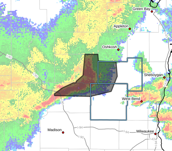

UPDATE at 10:00 p.m.: The Severe Thunderstorm Warnings for eastern Fond du Lac and northeastern Dodge counties have now expired.
UPDATE at 9:40 p.m. on 7/8/2026: The National Weather Service reports that at 9:33 p.m., a severe thunderstorm was located 7 miles north of Sun Prairie, moving east at 40 mph.
The Severe Thunderstorm Warning for Southwestern Dodge county has been cancelled, but remains in effect for eastern Fond du Lac county and northeastern Dodge county until 10:00 p.m.
The storm which prompted the warning has weakened below severe limits, and no longer poses an immediate threat to life or property. Therefore, the warning has been cancelled. However, gusty winds are still possible with this thunderstorm.
A Severe Thunderstorm Watch remains in effect until 10:00 p.m. for south central and southeastern Wisconsin.
UPDATE at 9:25 p.m. on 7/8/2026: The National Weather Service is reporting a severe thunderstorm was located near Deforest, or 7 miles north of Windsor, moving east at 40 mph.
The Severe Thunderstorm Warning continues for Fond du Lac and Dodge counties until 10:00 p.m.
UPDATE at 9:15 p.m. on 7/8/2026: The National Weather Service extends the Severe Thunderstorm Warning for Fond du Lac and Dodge counties until 10:00 p.m.
At 9:08 p.m., severe thunderstorms were located along a line extending from near Rush Lake to near Rosendale to near Waupun to 7 miles northeast of Beaver Dam, moving east at 40 mph.
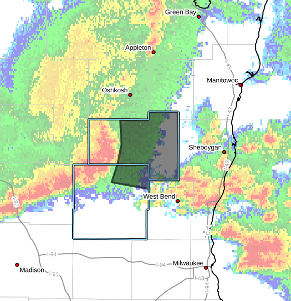
MILWAUKEE — The National Weather Service issues a Severe Thunderstorm Warning for Fond du Lac and Dodge Counties until 9:30 p.m.
Severe Thunderstorm Warning including Lake Wisconsin WI, Lodi WI and Poynette WI until 9:30 PM CDT pic.twitter.com/AaruD1RpNW
— NWS Milwaukee (@NWSMilwaukee) July 9, 2026
At 8:38 p.m., severe thunderstorms were located along a line extending from near Berlin to near Markesan to near Cambria to near
Portage, moving east at 30 mph.
Hazards include 60 mph wind gusts and expect damage to roofs, siding, and trees.