


SULLIVAN, Wis. – The National Weather Service has issued a Tornado Watch for all of Southeast Wisconsin until 10:00p.m. April 14.
Forecasters predict a round of strong to severe thunderstorms capable of producing widespread very large hail up to 4 inches in diameter, damaging winds with isolated gusts up to 75 mph, and strong tornadoes will begin in the late afternoon hours and continue through around midnight.
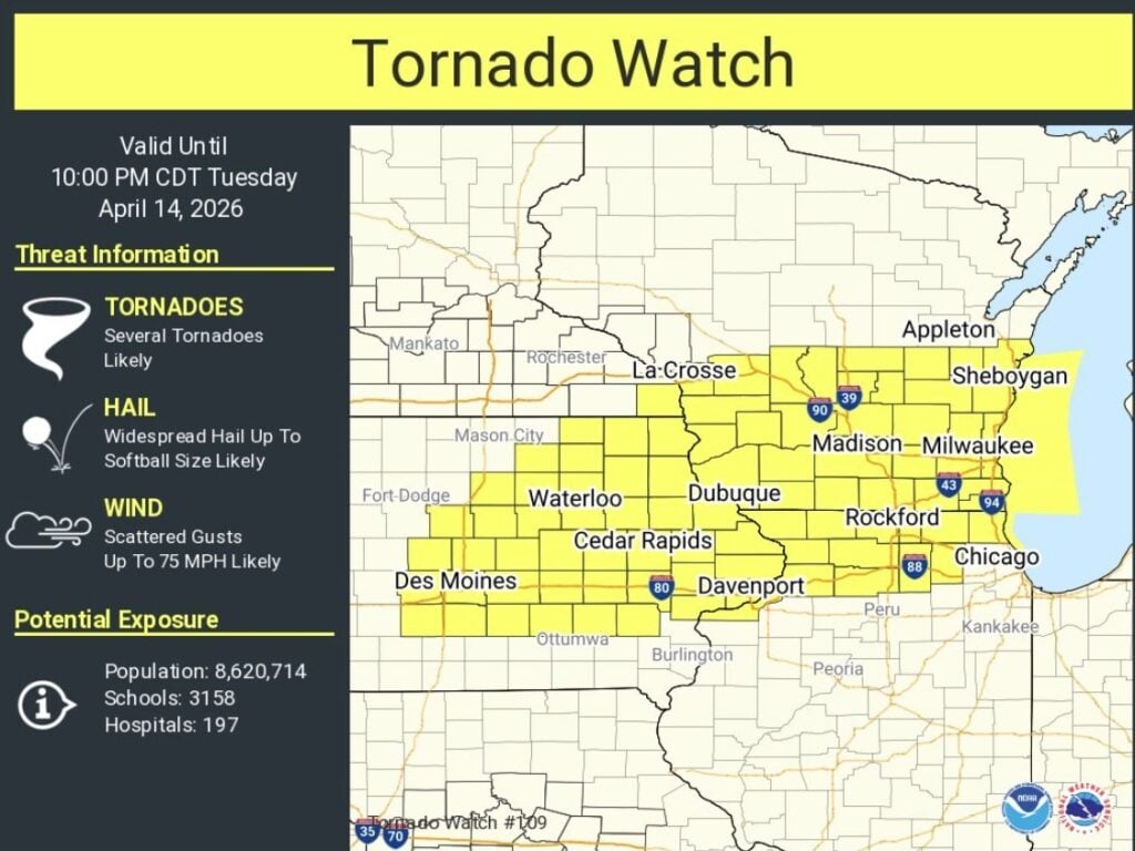
A front that brought severe weather to Southeast Wisconsin overnight is lifting back north; where that front sets up will determine which areas are most likely to see severe thunderstorms.
Milwaukee Public Schools is cancelling all extra-curricular activities this evening in anticipation of severe weather. Schools will dismiss students at the regular time, and all after-school camps, Safe Places, and Community Learning Centers (CLC) will remain open for students, but families are strongly encouraged to pick up their students early.
The Pewaukee School District cancelled classes April 14 after an outage caused by storms early in the morning. As of 4:00p.m., more than 12,000 We Energies customers across Wisconsin are still without power, according to the utility’s outage map.
Stay tuned to 620 WTMJ for complete severe weather coverage on-air, online, and on the WTMJ Mobile App.
You can access the WTMJ Interactive Radar anytime by clicking here.